
Black Squirrel, White Squirrel
2025
Research-driven mobile app for documenting and mapping rare squirrel variants in the Twin Cities metro area.
Context
The Twin Cities have a long-documented history of rare squirrel populations, especially white squirrels (leucistic and albino), due to a combination of genetic isolation, urban park ecosystems, and long-term human coexistence. Despite widespread local awareness, sightings are typically shared informally on social media, lacking geographic context and missing educational clarity around what type of squirrel is actually being observed. This project began as an exploration into how design and technology can support citizen science while remaining respectful of wildlife and privacy.
Problem
- •No centralized way to log or visualize sightings
- •Frequent confusion between leucistic, albino, and melanistic squirrels
- •Existing wildlife platforms are either overly complex or not locally relevant
- •Location data raises privacy and ethical concerns if handled carelessly
Solution
- •A simple, map-based mobile app that allows users to:
- •Log squirrel sightings with optional notes and photos
- •Filter sightings by squirrel type and time range
- •View aggregated patterns without exposing precise locations
- •Learn the differences between rare squirrel variants
- •The app prioritizes clarity, restraint, and education over gamification.
Role & Responsibilities
- •Product concept & research
- •UX/UI design
- •Visual identity & icon system
- •Mobile app development (Expo / React Native)
- •Map integration & filtering logic
- •Privacy-conscious data handling
- •Testing via Expo Go and device previews
Gallery
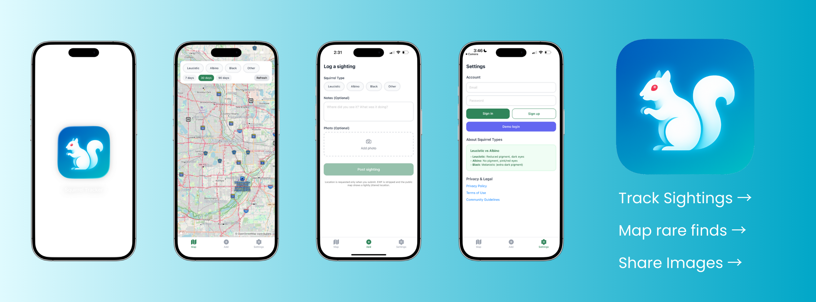
Product Screens
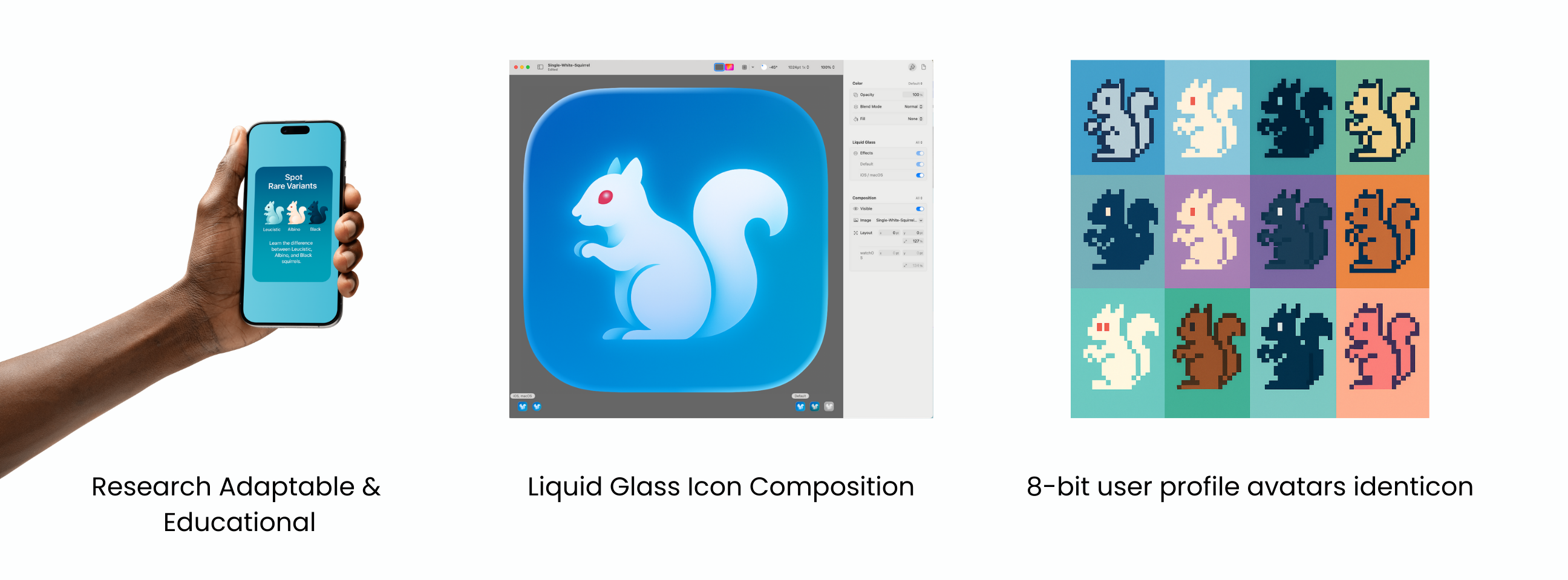
Design System & Identity
Process
The app icon was designed using Apple's Liquid Glass aesthetic, emphasizing softness, approachability, and depth. The squirrel form is intentionally simplified and symbolic rather than literal. To support personalization and play, I also designed an 8-bit squirrel avatar system, allowing users to visually identify with different variants while keeping the core UI clean. The UI uses a calm, low-contrast color palette inspired by local skies and lakes, with clear typographic hierarchy and a map-first interaction model. Educational UI is embedded directly into flows (not hidden in menus). Product features include map-based sighting visualization, variant filters (Leucistic, Albino, Black, Other), time range filtering, optional photo uploads, educational reference panels, demo login for exploration, and privacy-aware location handling.
Outcome
The app is currently in active beta, tested via Expo Go and real-world use. While not yet launched on the App Store, it has proven effective as a research and design case study, a demonstration of full-stack mobile product thinking, and a platform for future expansion into community science tools.
Future Considerations
- •Public / private visibility controls for sightings
- •Seasonal pattern analysis
- •Exportable datasets for local research groups
- •Accessibility refinements
- •App Store launch with community guidelines